EPS undergrads sharpen their field skills at UNM Field Camp 2024
Departmental News
Posted: Jul 24, 2024 - 12:00am
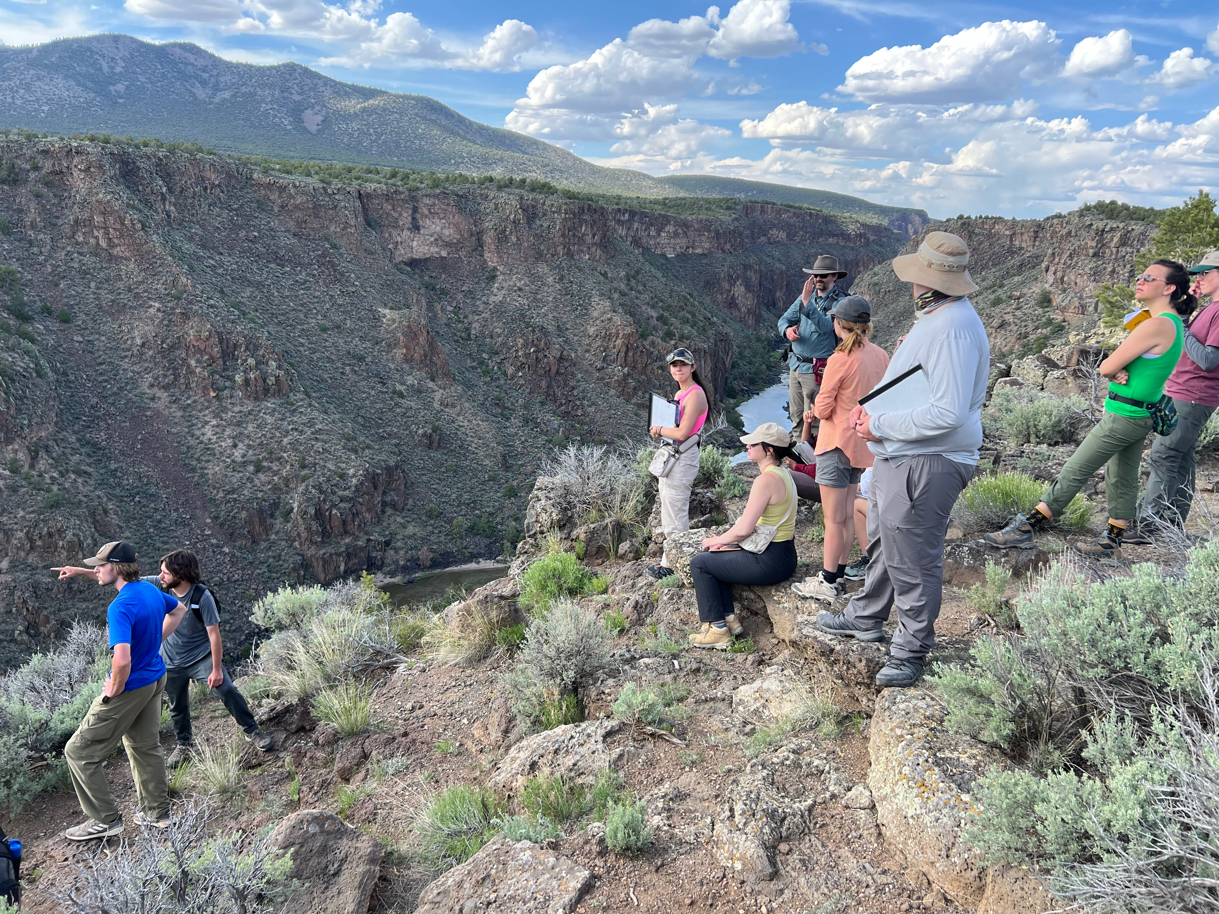
At the beginning of this summer, graduating seniors in the UNM Earth & Planetary Sciences (EPS) Department took part in a three-week capstone field course (EPS 319) from May 13-24, 2024. This year, the course was led by Assistant Professors Dr. Tyler Mackey and Dr. Marisa Repasch. By immersing students in new field areas, they challenged students to build on the skills and knowledge they developed during their undergraduate program and develop new field-based research skills. This course also offered the opportunity to learn camping and outdoor skills that are often needed in Earth Science careers. (Picture below: Dr. Tyler Mackey and students make observations and discuss the geologic setting of the Rio Grande Gorge near Questa, NM. Photo credit: Marisa Repasch.)
This year, EPS 319 encompassed four modules, each focused on a distinct field area with unique geologic features. During module 1, the students investigated the downstream effects of the Cochiti Dam on sediment transport and hydrologic regime in the middle Rio Grande near Albuquerque, NM. Students visited four field sites at increasing distances downstream from the outlet of the dam. At each site, they collected sediment grain size data, as well as samples to analyze in the laboratory. After two days of field work, the students returned to the UNM Surface Processes Lab to analyze the grain size distributions of their sediment samples and detect downstream changes.
For module 2, the group traveled to northern New Mexico and camped for four days and three nights at the rim of the Rio Grande Gorge. Here, the students were challenged with their first mapping project, where they applied their spatial and temporal reasoning skills to interpret the geologic and geomorphic evolution of the northern Rio Grande Rift. Utilizing the exposures of basalt flows and Santa Fe Group sedimentary units within the gorge, the students identified multiple sequences of volcanic activity with intermittent periods of soil development and river sediment deposition. They also identified ancient river gravel deposits located high above the modern river, finding that the river carved the gorge rapidly within the last 1 million years.
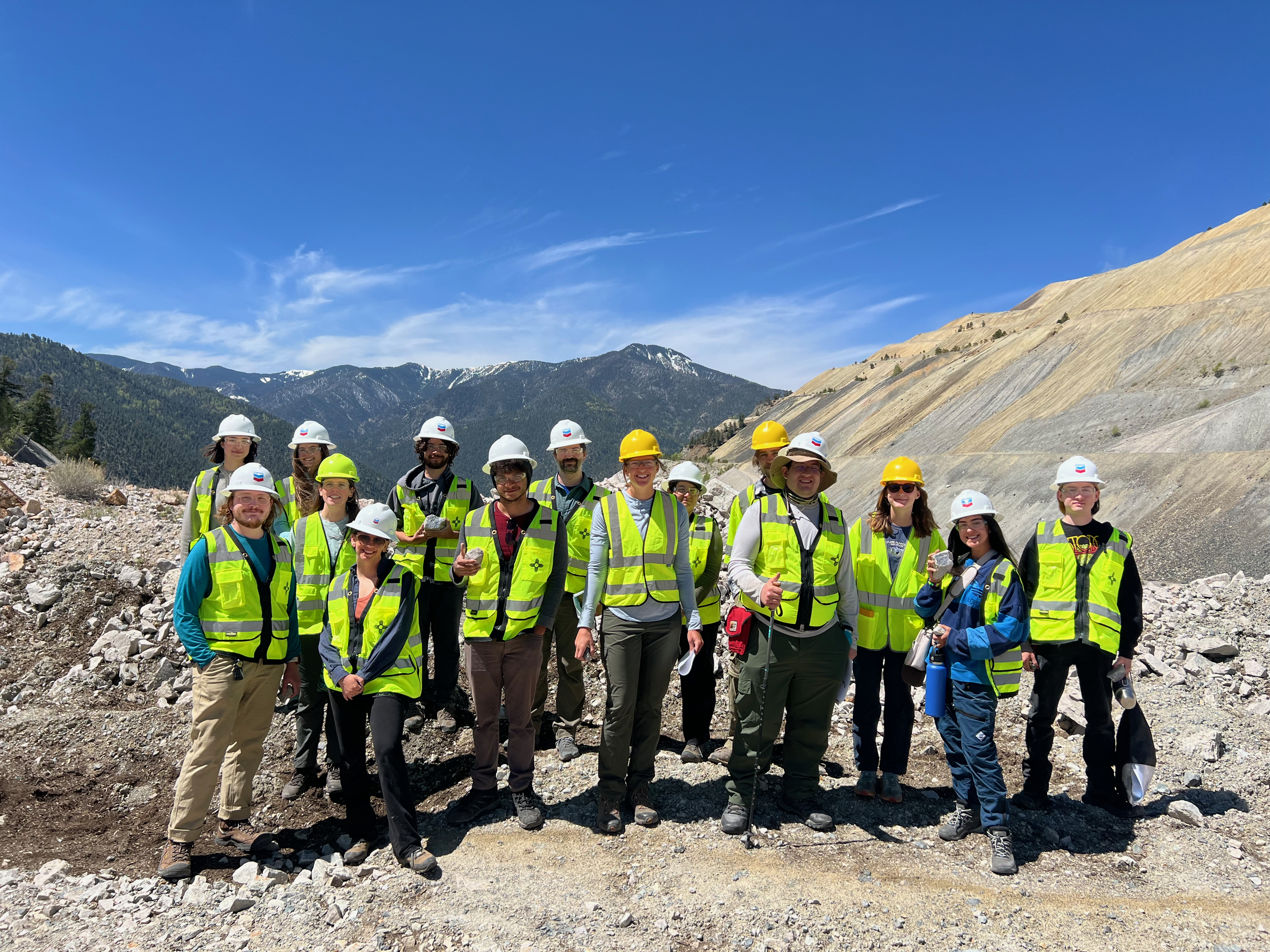
Before heading back to Albuquerque, the group went on a guided tour of the Chevron Questa Molybdenum Mine, which is undergoing a major environmental remediation project. Staff hydrologists, engineers, and geologists from Chevron and Arcadis introduced our students to the complex geochemical reactions that have been accelerated as pyrite-bearing bedrock was unearthed, including sulfuric acid production. Students learned about the different remediation approaches that Chevron is applying to treat the local groundwater and surface water and to stabilize the steep talus slopes. (Phoeo below (EPS 319L students and instructors at the Questa Molybdenum Mine. Photo credit: Gabriel Herrera.)
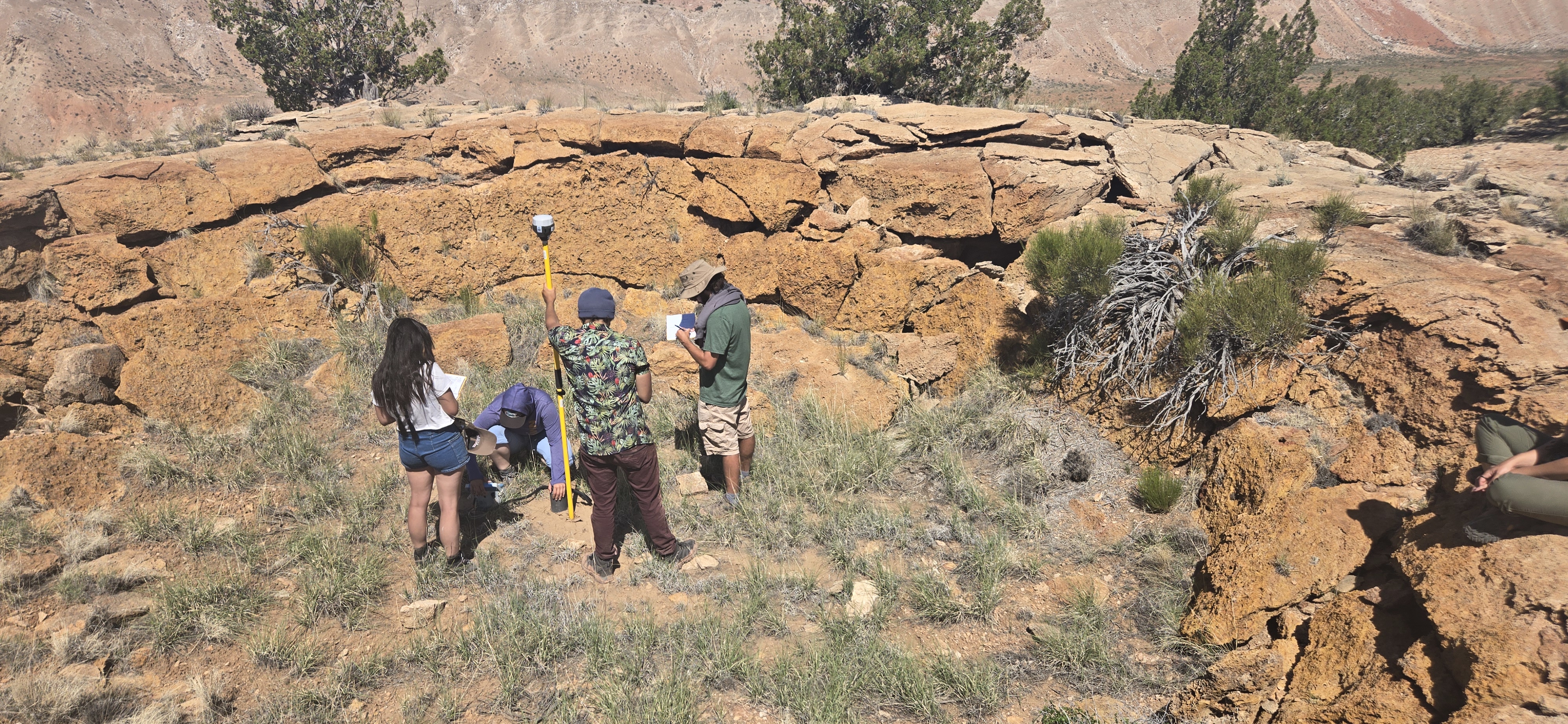
During the third module of field camp, Professor Brandon Schmandt led an investigation of the complex structural setting near San Ysidro, NM. Using modern geophysical tools, including ground penetrating radar (GPR), along with RTK GPS surveys, and CO2 flux surveys, the students tried to identify and map the extent of faults that have little to no surficial expression. Using these tools, the students created high-resolution 2D radar images of the shallow subsurface, looked for elevation offsets at the surface, and tried to detect changed in CO2 outgassing from the ground across an area where researchers have proposed the existence of normal faults. After collecting field data for three days and camping for two nights outside of San Ysidro, the students returned to the computer lab to learn how to analyze and process the geophysical data to make interpretations about subsurface structures. (Photo below: EPS 319L students conducting a differential GPS survey across a fault near San Ysidro, NM. Photo Credit: Lexi Kenis.)
During Module 4, the group returned to the San Ysidro area, this time with a different objective. The students took on a complex geologic mapping project, with the goal of identifying, mapping, and characterizing geologic contacts, folds, and faults that cut through the field area. Students spent four days diligently collecting field data and creating detailed geologic maps and cross-sections. This activity challenged the students to hone their spatial reasoning skills, as well as integrate multiple types of data to interpret the geologic history of the landscape.
After completing these four modules, the students dove deeper into a project they were most passionate about. The class was divided into four groups, each tackling one of the modules described above. The students advanced their initial project results using computational data analysis, digital mapping in ArcGIS, and figure creation in Adobe Illustrator to answer a specific research question. To communicate their findings, each group created a conference-style poster, which they presented to the department on the final day of the course.
Through this immersive field experience, students developed new skills in field observation and data collection, as well as using digital tools to analyze and present research results. Some students also walked away from the course with a newfound appreciation for camping and are now equipped with the skills and equipment needed to pitch a tent, cook, and enjoy nights spent outdoors. Overall, we think UNM Field Camp 2024 was a success!
